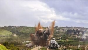
In November 2024, an Israeli strike killed twenty people in Almat, which a wire report described as a Shia-majority village in a mostly Christian region, outside Hezbollah’s traditional strongholds of south Beirut, the south and the east.[i] The description is accurate, but it also illustrates the limitations of the geographical categories through which Hezbollah’s presence in Lebanon is usually understood. Almat lies in Jbeil District, which Lebanon’s confessional map codes as Christian. Read at district scale, therefore, the Shia village disappears, making a strike that is explicable at the locality level appear anomalous.
Lebanon is now disarming Hezbollah at much the same scale. The sect map –the Shia south, the northern Bekaa and Beirut’s southern suburbs – describes the group’s constituency reasonably well, but performs much less reliably as a guide to the location of depots and command nodes because several sources of distortion compound one another. Lebanon has held no census since 1932, leaving the electoral register as the working demographic proxy. That register records a voter’s ancestral village rather than current residence and is then read at the level of the qada, the administrative district, averaging away the localities within it. The most recent version available in disaggregated form dates from 2018, and therefore predates the displacement of the last two years.
Aggregate strike data cannot resolve the problem. Of 313 airstrikes between the November 2024 ceasefire and April 2025, the split division between the area south of the Litani and everything north of it was close to even.[ii] That aggregation cannot distinguish cases that confirm the conventional map from those that challenge it. For that purpose, the useful cut is by function rather than region. Both datasets used here come from Alma Research and Education Center, an Israeli research institute whose target designations identify where Israel believes Hezbollah infrastructure sits rather than independently confirming that it does. That limitation does not prevent the comparison, because the question tested is narrower: whether the confessional map predicts those locations Israel identifies as Hezbollah infrastructure.
Which arrays are fixed
Sorted by function, the targets Israel struck in April 2026 reveal a distinction that the sectarian map obscures. Four of the six arrays lie within the Shia belt, while two – command and supply – do not.
On 8th April 2026, Israel struck more than 100 targets in roughly ten minutes, its largest single action in Lebanon since fighting resumed on 2nd March.[iii] The rocket and missile array was targeted at Nabatieh and Iqlim al-Toufah, the Radwan units in the southern rear, the strategic and air-defence array around Baalbek and Hermel, and naval and UAV units on the coast. Command and intelligence targets, by contrast, included safe apartments and command centres at Ain al-Mraiseh, Basta, Corniche al-Mazraa and Msaytbeh, in municipal Beirut and outside Dahiyeh, while the logistics array was located in four localities of Aley District.[iv]
Aley
A politically and militarily legible geography at locality level becomes misleading once translated into district categories.
At district scale, Aley reads as Druze, making the presence of Hezbollah depots there appear to cross a confessional boundary. At locality scale, however, the named sites sit on Shia ground that the register does not adequately display. Alma’s localities include Kaifun and Sahra Choueifat, both exceptions to the district-level picture. Kaifun is one of two towns, together with Qmatiyeh, in which Aley’s Shia population was already concentrated before 2024, according to Rabeh Haber, director of Statistics Lebanon.[v] Sahra Choueifat is counted as part of Dahiyeh’s built continuum alongside Hayy al-Sellom.[vi] Hezbollah therefore need not have crossed a confessional line here. In both Jbeil and Aley, the grid is simply too coarse to show where the line actually runs.
That distinction is not merely demographic. In May 2008, Hezbollah checkpoints between Qmatiyeh and Souk el-Gharb produced days of fighting through Choueifat and the villages around Aley, in that case against the Progressive Socialist Party rather than Israel.[vii] Reporting on 8th April 2026 again placed strikes in both Qmatiyeh and Souk el-Gharb,[viii] illustrating how a politically and militarily legible geography at locality level becomes misleading once translated into district categories. A Lebanese raid on a depot at Sahra Choueifat, for example, would enter a municipality the state’s own rolls assign to the Druze and would therefore appear on paper as an operation against Druze ground, regardless of the actual target.
Sidon
In Sidon, the same problem reaches command rather than storage, but with an additional ambiguity. Alma lists the targets as Haret Saida and Sidon without distinguishing between them.[ix] Sidon is roughly 84 per cent Sunni among registered residents, whereas Haret Saida, on its eastern edge, is a Shia-majority municipality of about 19,600 people whose voters back Amal and Hezbollah.[x] A sector command could therefore lie inside a Shia enclave that the national map fails to display. does Alternatively, it could lie inside the Sunni city itself, which would indicate that command infrastructure is less constrained by confessional geography than the conventional map assumes. The available data cannot distinguish those possibilities, which is a problem for any enforcement strategy relying on the same geographical categories.
Constraint and choice
The map finds Hezbollah most reliably where military requirements have already fixed its ground.
The split between the arrays is therefore neither random nor primarily a function of sect. Range to Israel helps determine the disposition of rockets and missiles, proximity to the front shapes Radwan deployments, access to the Syrian border matters for strategic depots, and the coast constrains the naval and UAV units. In Lebanon, those military requirements happen to correspond substantially with Shia geography, creating the impression that the sect map is doing more explanatory work than it actually is.
Command and logistics carry no equivalent constraint. They require road access to the units they serve, but within that requirement Hezbollah has considerably greater latitude in choosing their location, and it is precisely these functions that appear outside the districts the register codes as Shia. The significance is not simply that Hezbollah can be found beyond its traditional areas, but that the apparent predictive power of the sect map depends on a prior variable: military geography. The map finds Hezbollah most reliably where military requirements have already fixed its ground.
Part of the resulting advantage is physical. Materiel and commanders can sit outside zones that Israel had already saturated in the Shia core, but the institutional advantage may be more important and does not depend on Hezbollah having intended to exploit it. Registration data assigns those districts to other communities, while the enforcement lines Lebanon has drawn so far – the Litani and the Awali – track the same distribution. The Lebanese state and its partners have therefore built part of that advantage themselves, out of the data they use to see their own country.
After the Litani
Lebanon is disarming Hezbollah river by river, an approach that corresponds well to arrays whose locations are already constrained by military geography, but much less well to command and logistics. Phase one, south of the Litani, was declared complete in January 2026,[xi] while phase two, between the Litani and the Awali, was given four months in February, extendable, and rejected outright by Hezbollah.[xii] The framework agreement of late June further ties the territorial process together by making Israeli redeployment conditional on verified disarmament without committing Israel to full withdrawal.[xiii]
River lines can therefore work against arrays whose position military geography has already fixed, as phase one in the south was designed to do, but they are a much weaker instrument against functions that retain greater freedom of location. Command and logistics can move beyond the territory being cleared without ceasing to perform their function. This allows precisely the arrays least well captured by the sectarian maps to survive an enforcement process that moves north.
Phases three through five exist on paper and would carry the process north and east. However, constraints on the current timeline make their execution increasingly doubtful. UNIFIL’s mandate ends on 31st December 2026, removing the body that has performed municipal-level verification in the one area where it operates.[xiv] Phase two is likely to consume most of the remaining interval. At the same time, the framework’s central bargain – redeployment in exchange for disarmament – gives Lebanon little leverage to extend enforcement northwards while Israel continues to hold ground in the south and Hezbollah has surrendered nothing north of the Litani.[xv] On the present trajectory, the Awali is likely to become the point at which Lebanese enforcement stops, and the territory beyond it reverts largely to an Israeli targeting problem, preserving the advantage enjoyed by those arrays whose location is least constrained.
Communities in the receiving districts are already paying for this. A strike on Haret Saida, for example, registers at district scale as a strike on Sidon, while municipalities in those districts have imposed controls on rental and housing arrangements, partly out of concern that targeted individuals may be living among the new tenants.[xvi]
A map used for disarmament needs to describe where people and infrastructure are during the period in which disarmament is carried out, and in that period the population sits where the war has put it.
The political analyst Badih Qarhani argues that displaced southerners regard their situation as temporary and that any Hezbollah attempt to build strongholds outside its traditional areas would eventually reach a dead end against Lebanon’s sectarian composition.[xvii] That argument may prove correct over a longer demographic horizon, but it does not resolve the problem within the shorter enforcement window. A map used for disarmament needs to describe where people and infrastructure are during the period in which disarmament is carried out, and in that period the population sits where the war has put it.
Correcting the problem does not require a new census. Municipal residency and rental records are already being compiled in the receiving districts. The army generated its own returns south of the Litani during phase one, and the locality-level knowledge accumulated by UNIFIL since November 2024 will depart with the mission unless it is transferred first.[xviii] Consolidating material that the Lebanese state and its partners already possess into a single locality-level layer would therefore provide a more useful basis for enforcement.
Lebanon has so far produced no such alternative map and shows no sign of commissioning one, with the result that north of the Awali, the only actor mapping Hezbollah’s command and logistics arrays at municipal resolution – and acting on the result – is the Israeli air force, and its map is a target list.
[i] VOA News (2024). “Lebanon says 20 killed in Israeli strike north of Beirut”, 10 November 2024, retrieved from: https://www.voanews.com/a/7858334.html.
[ii] Alma Research and Education Center (2025). “Data Analysis: Israeli Airstrikes in Lebanon (November 27, 2024 – April 18, 2025)”, 21 April 2025, retrieved from: https://israel-alma.org/data-analysis-israeli-airstrikes-in-lebanon-november-27-2024-april-18-2025/.
[iii] Daoud, D. (2026). “A breakdown of Israel’s heavy bombardment of Beirut on April 8”, FDD’s Long War Journal, 11 April 2026, retrieved from: https://www.longwarjournal.org/archives/2026/04/a-breakdown-of-israels-heavy-bombardment-of-beirut-on-april-8.php.
[iv] Beeri, T. (2026). “Analysis of the Strike on April 8 Against Hezbollah Targets (Beirut, Southern Lebanon, Bekaa)”, Alma Research and Education Center, 14 April 2026, retrieved from: https://israel-alma.org/analysis-of-the-strike-on-april-8-against-hezbollah-targets-beirut-southern-lebanon-bekaa/. The array attribution and all locality names in this paragraph are Alma’s.
[v] Rabeh Haber, director of Statistics Lebanon, quoted in Chbaro, A. (2026). “Mass Displacement from Southern Lebanon Raises Questions About Demographic Change”, Alhurra, 14 May 2026, retrieved from: https://alhurra.com/en/20508.
[vi] Jebai, R. (2026). “A Suburb in Full: From Lemon Blossoms to Hezbollah”, Alhurra, June 2026, retrieved from: https://alhurra.com/en/8154.
[vii] ReliefWeb (2008). “LEBANON: Opposition continues military takeover, enforces siege”, 11 May 2008, retrieved from: https://reliefweb.int/report/lebanon/lebanon-opposition-continues-military-takeover-enforces-siege; Alami, A. (2008). “LEBANON: Druze Take On Hezbollah, Because They Must”, Inter Press Service, 21 May 2008, retrieved from: https://www.ipsnews.net/2008/05/lebanon-druze-take-on-hezbollah-because-they-must/.
[viii] Daoud (2026). “A breakdown of Israel’s heavy bombardment of Beirut on April 8.”
[ix] Beeri (2026). “Analysis of the Strike on April 8.”
[x] Knudsen, A.J. (2020). “Sheikhs and the City”, Conflict and Society, 6(1).
[xi] Al Jazeera (2026). “Lebanon army says phase one of disarming non-state groups in south complete”, 8 January 2026, retrieved from: https://www.aljazeera.com/news/2026/1/8/lebanons-army-says-phase-one-of-hezbollah-disarmament-in-south-completed.
[xii] Al Jazeera (2026). “Lebanon sets four months for second phase of Hezbollah disarmament”, 17 February 2026, retrieved from: https://www.aljazeera.com/news/2026/2/17/lebanon-says-four-months-needed-for-second-phase-of-hezbollah-disarmament.
[xiii] Mizrahi, O. (2026). “The Framework Agreement Between Lebanon and Israel: A Positive First Step on a Long Road to Change”, Institute for National Security Studies, 2 July 2026, retrieved from: https://www.inss.org.il/publication/israel-lebanon-agreement-2026/.
[xiv] House of Commons Library (2025). “Lebanon and the end of UNIFIL’s mandate in 2026”, Research Briefing CBP-10348, July 2026, retrieved from: https://commonslibrary.parliament.uk/research-briefings/cbp-10348/.
[xv] Mizrahi (2026). “The Framework Agreement”.
[xvi] Chbaro (2026). “Mass Displacement from Southern Lebanon”.
[xvii] Badih Qarhani, quoted in Chbaro (2026). “Mass Displacement from Southern Lebanon”.
[xviii] Wood, D. (2025). “Helping UNIFIL Restore Stability in Southern Lebanon”, International Crisis Group, 14 August 2025, retrieved from: https://www.crisisgroup.org/cmt/middle-east-north-africa/lebanon/helping-unifil-restore-stability-southern-lebanon.